
- Sun - Oct 18, 2026 - Colonel Denning
-
Navigate → 🌎
W Y O Br G R

Event Director: Mary Frank 16103104675
Course Setter: Rob Wilkison
Pre-register Here (recommended) or Check Who's Registered 👥
Notes: 10am to Noon. There is now hunting on Sundays in PA so wear some blaze orange for going into the woods. DVOA in cooperation with the park will be conducting a beginners clinic at the registration pavilion starting at 10am.
ED/CS Notes:
NOTE: Due to the limited registration versus the course maps printed you can register on site for this event. Regular pre-registration fees apply. Please bring exact amount
Colonel Denning State Park is nestled within Doubling Gap, which is formed by a ridgeline doubling back on itself. A stream (Doubling Gap Creek) runs through the Park, and it has been damed up at one point to create a small lake, which has a sandy beach and swimming area. Because of the rather narrow valley, advanced courses will have a bit more climb than usual for DVOA events. There are 3 footbridges over Doubling Gap Creek upstream of the lake and the dam, a park road and another footbridge downstream of the lake. The creek is not much more then ankle depth upstream of the lake and maybe up to mid-calf below the dam.
Pennsylvania has recently expanded Sunday hunting from 3 times a year to most fall weekends. In October, the main hunting is archery deer season. Much of the Park is no-hunting, and the white and yellow courses are entirely in no-hunting zones, but the orange and brown courses go into an area of the park where hunting is permitted, and the red and green courses go through the park hunting areas and also state forest land across Route 233 where hunting is permitted. Most archery hunters are in tree stands. It is strongly recommended everyone wear a fluorescent orange or other brightly colored top/vest (not brown).
There are a lot of rootstocks shown on the map, in areas which have not been recently field checked. Some of the mapped rootstocks have turned into small knolls or have disappeared completely. Many rootstocks are visible which do not appear on the map and are not reliable attackpoints.
All courses will cross a park road, which has a 15 mph speed limit and little traffic beyond the main parking area. Red and Green courses will cross PA Route 233 twice. There is not a lot of traffic on this road, but what there is will often exceed the 35 mph speed limit when going up or down a fairly steep hill.
There will be not be water on the courses.
Current weather predictions as of a week before the event are dry and with high temperatures only in the low to mid 50s.
Map Location:
Previous Results from this Map:
Oct 18, 2026
May 28, 2023
Jul 11, 2021
Jun 09, 2019
May 21, 2017
Courses Information:
Course Distance Climb Ctrls White 1.85km 50.0m 8 Yellow 2.40km 85.0m 10 Orange 3.65km 145.0m 9 Brown 4.00km 135.0m 12 Green 5.60km 240.0m 12 Red 6.70km 275.0m 16
Full Schedule (old style)
PDF Schedule
Unless otherwise noted:
- Pre-registration is recommended, discounted, and open until Thursday night, before the event.
- Day-of-registration is available, at $10 for beginners, and $20 for other courses.
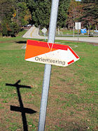
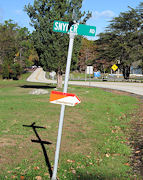
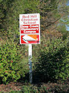
All starts are from 10:00am until 1:00pm unless otherwise noted. Follow the text directions and look for Orienteering road signs as you near the park.
| Legend | |
| W | White, beginner level 3km or less |
| Y | Yellow, advanced beginner 2.5 to 4km |
| O | Orange, intermediate 3.5 to 5.5km |
| Br | Brown, Short Advanced 3 to 5km |
| G | Green, Advanced 4.5 - 7km |
| R | Red, Longer Advanced 6 - 10km |
| Bl | Blue, Long Advanced 8 - 14kms |
| Sc | Score-O |
| Sp | Sprint-O |
| Adv | Advanced |
 |
E-Punching |
 |
Confirmed Event |
| Special Event | |
| Example O-Signs: | |
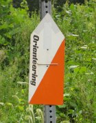
| |
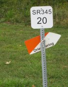
| |

| |
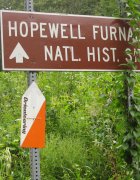
| |
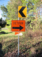
| |
| |
| |
| |