DVOA Event Schedule
We use online preregistration for all of our events (at a significant discount versus day-of-event rates.) Links to register are listed below. Deadline to register is normally the Thursday before the event.
Walk in day-of-event registration is available unless otherwise noted, but map/course selection may be limited. Cost for registering at the event is $10/map for the white/beginner course and $20/map for all other courses.
See below for a note about risks you assume while orienteering, including Covid-19 information.

Course Setter: Ian Whitehead
Pre-register Here or Check Who's Registered
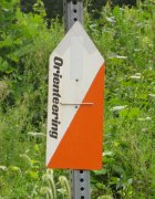
Directions: NJ Rt 70 East of Medford NJ to Four MIle Circle, the junction of NJ 70 and 72. Follow Orienteering signs from there.
Courses Information:
| Course | Distance | Climb | Ctrls |
|---|---|---|---|
| White | 2.40km | 10.0m | 10 |
| Yellow | 3.20km | 15.0m | 12 |
| Orange | 4.50km | 25.0m | 12 |
| Brown | 3.90km | 20.0m | 13 |
| Green | 5.20km | 30.0m | 13 |
| Red | 7.30km | 45.0m | 21 |
| Blue | 10.30km | 65.0m | 30 |

Course Setter: Yury Tambasov
Directions: From Exit 26 of the PA Turnpike follow PA Rt. 309 south to Rt. 73. Take a right onto Rt. 73 and follow it north and west and watch for O'-signs.

Course Setter:
Notes: BEGINNER PROGRAM, MEET AT EDUCATIONAL BARN CLASSROOM @ 10 AM
Directions: South side of Germantown Pike, midway between 202 and 363, just east of the crossing with Whitehall Road.

Course Setter: Mark Frank
Pre-register Here or Check Who's Registered
Notes: Beginners event. Program starts at 10am in classroom at education center. Beginner course follows from 11am to Noon. Fee is $5/map. Online registration will be available approimately 1 month prior to event.
Directions: From Interstate 81, take Exit 37. At the exit, travel south on Route 233 about 2.5 miles. Turn left onto Pine Road and continue 2.5 miles. The entrance to the center is on the right. Follow O-signs.

Course Setter: Glen Lewis
Directions: From PA Rt 1 take PA Rt 896 south toward Newark, DE and watch for O'-signs, or from I-95 take DE 896 North to park.

Course Setter: Dmitry Lavrov
Directions: From N & W: NJ Turnpike Exit 8 to Rt 33 East for 5 mi. Rt 527Alt North/Iron Ore Rd. From E: Garden St Pkwy Exit 100A to Rt 33 W for 16 mi. to Rt 527Alt/Iron Ore Rd. Then North 1/4 mile on 527Alt to Quail Hill sign, turn right onto Le Valley Rd into camp.


Course Setter:
Notes: Event is from Friday 3/20/26 through Sunday 3/22/26. See OUSA website for registration information. You do not need to qualify to attend. **2026 US Nationals website**


Course Setter:
Notes: 3 & 6 hour Mini-rogaine hosted by the Western PA Orienteering Club

Co-Director: Victor Frolenko
Course Setter: Francis Hogle
Notes: Date pending Permissions
Directions: From I-95 take DE Rt.896 South. Go to Old Baltimore Pike and take a Right, West on Baltimore Pike. The park entrance and then the church parking will be on your right. Follow the O'-signs.
W Y O Br G R Bl Sprint-O
 Volunteer to help at this event

Course Setter: Samuel Kolins
Pre-register Here or Check Who's Registered
Directions: From US Rt 22, take PA 145 north (MacArthur Rd) for about 4.5 km. Turn left on S. Church St. After about 1.5 km, see parking on right.
ED/CS Notes:
We are debuting a super-cool new map by Petr Hartman!
Event will have a middle + sprint format to best take advantage of this unique terrain.
Full course notes and distances here.
The property was previously a quarry and cement plant and the map contains many remnants of human activity that make for fascinating and unique orienteering. There are many cliffs of various sizes created by the quarries and a substantial number of ruins related to the cement operations. Many of the ruins are factory-sized buildings that we are able to run through, making for terrific sprint terrain. The lakes filling the old quarries give the site a special beauty. Overall a very cool place to experience!


Course Setter:
Notes: This event is from Friday April 10th through Sunday April 12th. Pre-registration is required. See OUSA website for information.


Course Setter:
Notes: Pre-registration required. See OUSA website


Course Setter:
Notes: Pre-registration required. See OUSA website.


Course Setter: Mark Frank
Notes: S-MASOC 2026
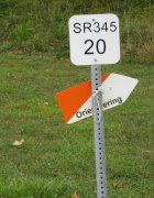
Directions: Follow PA Rt.23 to Rt.345, take Rt.345 north and watch for O'-signs.

Course Setter: Mark Frank
Directions: Follow PA Rt.23 to Rt.345, take Rt.345 north and watch for O'-signs.


Course Setter:

Course Setter: Samuel Kolins
Directions: From Langhorne, PA follow PA Rt. 413 North toward Newtown and watch for O'-signs.
ED/CS Notes:
Score-O/Mini Rogaine covering the entire Core Creek Map.
Find as many controls as you can in either 1.5 or 2.5 hours.
We will have controls for all levels from first-timers to advanced, so everybody is welcome.
We will have a pizza lunch at the finish where you can share routes and stories with the other orienteers.
- 2.5 hour course: Check-in 9:30-10:30AM, Maps distributed at 10:00AM. Mass start at 10:30AM. Finish time 1:00PM.
- 1.5 hour course: Check-in 10:30-11:00, Maps distributed at 11:00AM. Mass start at 11:30. Finish time 1:00PM.
- You can also start the 1.5-hour course any time from 10:30-11:30, but you will be back to finish before the pizza arrives!
Cost is $15 for members, $20 for non-members, and $10 for all juniors. Pizza cost is $5/person.
For more details, see the course notes here.
Courses Information:
| Course | Distance | Climb | Ctrls |
|---|---|---|---|
| Score-O | 13.30km | 0.0m | 53 |
| Score-O | 19.10km | 0.0m | 53 |

Course Setter: Yury Tambasov
Notes: US WOC Team Trials sprints plus public courses on a new map of Rutgers-Cook/Douglass campus Event Website

Course Setter: Yury Tambasov Co-Setter: Alex Azarov
Notes: Possible US Team Trials, NRE and Local Sprint Event Website


Course Setter: Ian Whitehead
Notes: Starts 10 am to Noon.
Directions: From I-476N use exit 18A to Ridge Pike, go southeast. From I-476S exit at 18B and use the U turn at Allanwood. From I-76 use exit 338 Green Lane, follow N to left turn on Ridge Pike. Look for signs at corner of Ridge Pike and Port Royal Ave.

Course Setter:
Directions: From King of Prussia follow US 422 west to Oaks Exit. At the bottom of the ramp turn right at the light then make another right at the next light. Follow O-signs to parking. From Pottstown follow US 422 east to the Oaks Exit. Stay right at end of ramp and yield on to Egypt Road. Go under 422 and make a right at the 2nd light (before crossing bridge). Follow O-signs to parking.


Course Setter:
Notes: Events in Oregon and Washington state. Requires Pre-registration

Course Setter: Steve Aronson
Notes: Starts 4:30pm to 6:30pm
Directions: From the US22 and PA191 intersection, turn right and head north to the first traffic light. Turn left on to Broadhead Road and procede to Christians Spring Road on the left. Park is on right just after the stone bridge underpass.

Course Setter: Steve Aronson
Notes: Starts 4:30pm to 6:30pm
Directions: From I78E and PA-412 (exit 67) head left/south on 412 for three traffic lights (from I78W, south four traffic lights). Turn right on Water Street for 1/4 mile; Water Street Park is on the right. If Park lot is full, parallel park on Front Street (one block east of the Park). Thomas Iron Site is to the north of the Park lot.


Course Setter:
Pre-register Here
Notes: From July 25th to August 3, 2025 Preregistration is required. Includes 6 days of competition and fundraiser event.

Course Setter: Bob Agosta
Notes: Starts 10 am to Noon
Directions: From Newtown Square follow Rt.3 west approximately 2 miles to main park entrance on south side. Follow O'-signs.


Course Setter: Mark Frank
Notes: Annual Flashlight Night for Hollidaysburg!! Great Fun!


Course Setter:
Notes: Pre-registration required. See OUSA National Event site for link.

Course Setter: Bob Agosta
Notes: Updated map by JJ Cote
Directions: From US Rt. 30 Bypass north of Coatesville, take PA Rt. 82 north. Watch for left turn at top of hill. Follow O'-signs.


Course Setter:
Notes: Pre-registration required. See OUSA National event schedule for link.
A Message to our Membership and Orienteering Friends:
- Outdoor activies, including Orienteering have some inherent risks, and we ask that you assume those risks when you are out and about. These risks include both physical hazards, such as the rocks, stick and logs in our parks, as well as a risk of catching something from another person outside, including Covid-19.
- For a more isolated orienteering experience - our Permanent Courses await you any time*. (*Check with the specific park for their opening hours.)
- We also will continue to respect local COVID regulations - see specific event information for anything uncommon or changed vs. the new-normal expectations.
- Mask usage: Please continue to respect other Orienteers & Volunteers who have different COVID strategies than you do. At our registration, check-in and download areas in particular, please be respectful and keep your distance and/or wear your mask if they are masked.
- Starts: When you register for a specific start window, please aim to arrive in that timeframe. It helps spread out starters, and ensures participants don't have to wait very long to get out on their course.
- Online-pre-registration: watch for the deadlines a day or two before the event. Pre-registration ensures there will be a map available for you, and is significantly discounted vs. day-of rates.
- If you miss the pre-registration, onsite registration is generally available (without the discount), and you can check with the Event Director to confirm.
- Should you have any questions regarding a specific event, please feel free to click on the event director to clarify any specific needs you have.

